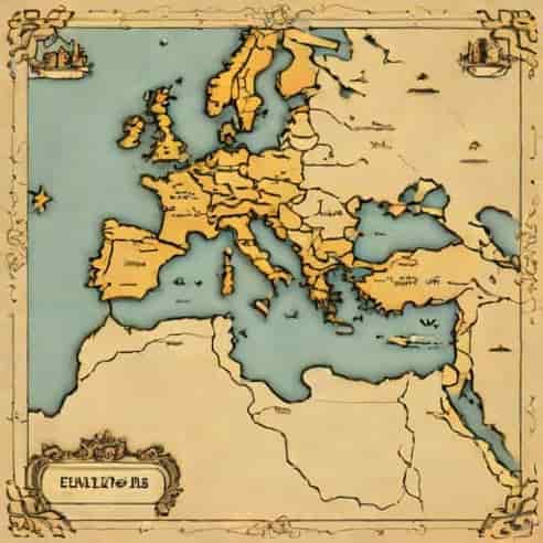
The Seleucid Empire was one of the largest and most influential Hellenistic kingdoms following the death of Alexander the Great in 323 BCE. Understanding its geography and territorial extent is essential for studying ancient history, trade, and cultural interactions across the Near East. A map of the Seleucid Empire helps visualize the vast lands it controlled, stretching from the eastern Mediterranean to parts of modern-day Iran, and illustrates the complexity of managing such an expansive realm. By exploring the locations of major cities, regions, and borders, we gain insight into the political, economic, and cultural significance of the Seleucid domain and its interactions with neighboring powers like the Ptolemaic Kingdom, Parthians, and Maurya Empire.
Origins of the Seleucid Empire
The Seleucid Empire was founded by Seleucus I Nicator, one of Alexander the Great’s generals, following the fragmentation of Alexander’s empire. Seleucus initially gained control over Babylon and gradually expanded his territory to encompass much of the eastern portion of Alexander’s former empire. At its peak, the Seleucid Empire included regions that are now part of modern-day Turkey, Syria, Iraq, Iran, Afghanistan, and Pakistan. The empire’s strategic location bridged the Mediterranean and the East, enabling trade, military campaigns, and cultural exchange.
Territorial Extent and Borders
The Seleucid Empire’s territory shifted over time due to wars, revolts, and treaties. At its height, it stretched from the Aegean coast in the west to the borders of India in the east, covering several diverse regions
- Western territoriesIncluded parts of Anatolia and Syria, giving the empire access to the Mediterranean and facilitating trade with other Hellenistic states.
- Central territoriesMesopotamia, including Babylon, served as the political and economic heart of the empire.
- Eastern territoriesReached into Persia, Media, and Bactria, which were crucial for controlling trade routes to Central Asia and India.
- Northern territoriesIncluded regions like Armenia and parts of the Caucasus, often contested by local rulers and neighboring empires.
Mapping these territories reveals the strategic importance of the Seleucid Empire and highlights its challenges in administration and defense over such a vast area.
Major Cities and Capitals
The Seleucid Empire was known for establishing several key cities that served as administrative, military, and cultural centers. A map of the Seleucid Empire often marks these cities as crucial points for understanding the empire’s organization and influence.
Babylon
Babylon, located in Mesopotamia, was one of the first major cities controlled by Seleucus I and served as a political and economic hub. Its strategic location along the Euphrates River facilitated trade and communication throughout the empire. Babylon also symbolized continuity with the ancient Mesopotamian traditions and served as a center for Hellenistic culture under Seleucid rule.
Antioch
Antioch, founded by Seleucus I on the Orontes River, became the empire’s western capital and one of the most important cities in the Hellenistic world. It served as a military stronghold, administrative center, and cultural hub, influencing art, architecture, and trade throughout the region. Antioch’s position near the Mediterranean enabled interactions with other Hellenistic kingdoms and facilitated maritime trade.
Seleucia-on-the-Tigris
Seleucia-on-the-Tigris was another major city established by Seleucus I, strategically located near Babylon. It functioned as a key administrative center and was a model of Hellenistic urban planning, featuring Greek-style architecture and institutions. This city illustrates how the Seleucid rulers sought to combine local traditions with Greek cultural elements to consolidate their authority.
Mapping the Seleucid Empire
Creating a map of the Seleucid Empire provides visual context for its geographic diversity and the challenges of ruling such an extensive domain. A typical map highlights
- The western Mediterranean frontier and coastal cities like Antioch and Apamea.
- The central Mesopotamian heartland, including Babylon and Seleucia-on-the-Tigris.
- The eastern regions extending to Bactria and Persia, showing the limits of Seleucid control in Asia.
- Natural features like the Tigris and Euphrates rivers, mountains, and deserts that influenced trade and military campaigns.
- Neighboring states, including the Ptolemaic Kingdom in Egypt, Parthian territories, and the Maurya Empire, to show geopolitical context.
Maps often use color coding or markers to indicate administrative regions, major trade routes, and military outposts. By visualizing these elements, we can better understand the empire’s logistical, economic, and military challenges.
Trade and Economic Significance
The Seleucid Empire’s geography allowed it to control crucial trade routes connecting the Mediterranean to the East. Cities like Antioch and Babylon acted as commercial hubs, facilitating the exchange of goods such as textiles, spices, metals, and agricultural products. Mapping trade routes alongside cities highlights how geography shaped economic activity and the movement of resources across the empire. The empire’s ability to manage trade and taxation in these regions was essential for maintaining political stability and funding military campaigns.
Military Routes and Defense
The vast size of the Seleucid Empire posed significant challenges for defense. A map of the empire shows key mountain passes, river crossings, and fortified cities that served as defensive positions. The Seleucid rulers relied on garrisons and fortified cities to secure borders and maintain control over distant territories. Mapping these strategic points provides insight into how the empire protected itself from invasions and internal revolts while projecting power over a vast and diverse population.
Cultural and Administrative Divisions
The Seleucid Empire was culturally diverse, with populations including Greeks, Persians, Babylonians, Jews, and other groups. Administrative divisions were often based on geographic and ethnic lines, allowing local governance while maintaining central control. Maps can illustrate these divisions, showing regions like Syria, Mesopotamia, Media, and Bactria, which had distinct local traditions but were integrated into the empire through Hellenistic institutions and governance structures.
Hellenistic Influence
The Seleucid Empire spread Greek culture and language throughout its territories, evident in city planning, architecture, coinage, and art. Mapping major Greek-influenced cities helps highlight the spread of Hellenistic culture from the Mediterranean to Central Asia. Cities like Antioch and Seleucia-on-the-Tigris became centers for Greek-style theaters, temples, and administrative buildings, blending local traditions with Greek cultural norms.
Decline and Fragmentation
The Seleucid Empire faced constant pressure from external enemies, internal revolts, and succession disputes. Over time, it gradually lost territory to the Parthians, Romans, and local kingdoms. Mapping the empire at different points in its history shows the contraction of its borders and the emergence of successor states. These maps provide valuable insight into the empire’s political history, illustrating how geography and military pressures influenced its decline.
Legacy
Despite its decline, the Seleucid Empire left a lasting legacy in terms of urban planning, cultural exchange, and trade networks. Maps of the empire help historians and students visualize the spread of Hellenistic influence and understand the connections between different regions. They also provide a framework for studying ancient history, archaeology, and the evolution of political and economic systems in the Near East.
A map of the Seleucid Empire is more than a visual tool; it is a window into the empire’s history, culture, and geography. By highlighting major cities, trade routes, administrative divisions, and natural features, maps help us understand the empire’s complexity and the challenges faced by its rulers. Studying these maps enhances our knowledge of ancient history, the spread of Hellenistic culture, and the interactions between different civilizations. The Seleucid Empire serves as a fascinating example of how geography, politics, and culture intersected to shape one of the most influential kingdoms in the ancient world.