Laurasia is often discussed in the context of Earth’s geological history as a significant landmass that played a crucial role in shaping the continents we recognize today. Many students, enthusiasts, and researchers in geology and paleogeography ask whether Laurasia is considered a supercontinent. Understanding Laurasia involves exploring its formation, its position in the timeline of Earth’s tectonic history, and its eventual breakup. This landmass provides insight into plate tectonics, continental drift, and the evolutionary pathways of both flora and fauna across vast regions of the Northern Hemisphere. By examining its characteristics and historical context, we can answer the question of whether Laurasia qualifies as a supercontinent and why it is important in Earth’s geological story.
Defining a Supercontinent
To determine if Laurasia is a supercontinent, it is essential to define what a supercontinent actually is. A supercontinent is typically described as a massive landmass comprising most or all of the Earth’s continental crust joined together. Examples of supercontinents include Pangaea, Rodinia, and Columbia. These formations significantly influence global climate, ocean currents, and biological evolution. Supercontinents form through the collision and amalgamation of smaller continents or cratons and eventually break apart due to tectonic forces, such as rifting and mantle convection.
Criteria for Supercontinents
Geologists generally consider several criteria when classifying a landmass as a supercontinent
- Size and CoverageIt must cover a substantial portion of Earth’s continental crust.
- Geological UnityThe landmass should be composed of multiple cratons or continental blocks that have collided and fused.
- LongevitySupercontinents usually exist for tens to hundreds of millions of years before breaking apart.
- Global ImpactThe formation and breakup of supercontinents influence global climate, sea levels, and biodiversity.
Formation of Laurasia
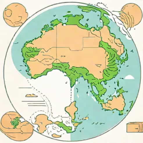
Laurasia was formed after the breakup of the supercontinent Pangaea during the Mesozoic Era, roughly around 200 million years ago. Pangaea split into two major landmasses Laurasia in the north and Gondwana in the south. Laurasia included the modern continents of North America, Europe, and Asia (excluding India). Its formation was the result of tectonic movements that separated these northern continental blocks from the southern hemisphere landmasses. Understanding this process is key to evaluating whether Laurasia fits the definition of a supercontinent.
Geographical Composition
Laurasia was composed of several major continental fragments
- North America, including parts of Greenland
- Europe, including parts of Scandinavia
- Asia, excluding the Indian subcontinent
These continental blocks were connected by tectonic activity, forming a coherent northern landmass. The unity of these blocks under Laurasia was less complete than in Pangaea but still significant in terms of geography and geological structure.
Debate Is Laurasia a Supercontinent?
There is some debate among geologists about whether Laurasia should be classified as a true supercontinent. While it was a large, connected landmass, it did not encompass as many continental blocks as Pangaea or other supercontinents. Some scholars argue that Laurasia is more accurately described as a continental assembly or a proto-supercontinent rather than a full-fledged supercontinent. Despite this, Laurasia had substantial influence on global geological processes, climate patterns, and the distribution of plants and animals.
Arguments for Laurasia as a Supercontinent
- It consisted of multiple continental blocks that were joined together after the breakup of Pangaea.
- Laurasia covered a vast area of the Northern Hemisphere, making it one of the largest landmasses of its time.
- Its formation significantly impacted ocean currents, climate, and biogeography, similar to other supercontinents.
Arguments Against Laurasia as a Supercontinent
- It did not include all major continental blocks of the Earth, unlike traditional supercontinents.
- Its assembly was less cohesive, with some tectonic gaps between blocks.
- Some geologists prefer to classify it as a continental fragment or a partial supercontinent.
Breakup and Legacy
Laurasia eventually broke apart due to continued tectonic activity, forming the continents we recognize today. The rifting that led to its fragmentation created the Atlantic Ocean and shaped the modern geography of North America, Europe, and Asia. This breakup also had major implications for climate, sea levels, and species evolution. Fossil evidence and geological formations across these continents reveal a shared history, confirming the connection through Laurasia. Its legacy is evident in mountain ranges, mineral deposits, and fossil distribution patterns that span multiple continents.
Impact on Biodiversity
The existence and breakup of Laurasia influenced the migration and evolution of many species. Land bridges allowed species to move between connected continents, while eventual separation led to speciation and diversity. This pattern of dispersal and isolation played a critical role in shaping the ecosystems of the Northern Hemisphere. Many modern plant and animal lineages can trace their evolutionary history back to the connected landmass of Laurasia.
Scientific Significance
Studying Laurasia is important for understanding Earth’s tectonic and evolutionary history. It helps geologists reconstruct past continental positions, understand plate movements, and analyze the effects of supercontinent cycles. Additionally, Laurasia’s formation and fragmentation provide insights into sediment deposition, mountain building, and paleoclimatology. Research into Laurasia also supports resource exploration, such as locating fossil fuels, minerals, and groundwater systems shaped by ancient geological processes.
Modern Research Techniques
- Paleomagnetism Tracking historical positions of continental blocks through magnetic orientation in rocks.
- Fossil Correlation Identifying similar species across continents to confirm connections.
- Geological Mapping Studying rock formations, fault lines, and mountain ranges to reconstruct Laurasia’s structure.
- Plate Tectonic Modeling Using computer simulations to understand the movement and interaction of Laurasia’s blocks.
Laurasia is a significant landmass in Earth’s geological history, formed from the northern fragments of the supercontinent Pangaea. Whether it is classified as a supercontinent is debated among geologists, due to its partial assembly and exclusion of southern continents. Nonetheless, Laurasia played a critical role in shaping modern continents, influencing climate, biodiversity, and geological formations. Its study provides valuable insights into tectonic processes, evolutionary biology, and Earth’s past environments. By examining Laurasia, scientists can better understand the supercontinent cycle, continental drift, and the historical forces that continue to shape our planet today.
In essence, Laurasia represents both a connection to the old supercontinent Pangaea and a precursor to the modern arrangement of Northern Hemisphere continents. Its impact on geology, ecology, and evolutionary history makes it a subject of ongoing research and fascination. Whether viewed as a supercontinent or a major continental assembly, Laurasia remains a cornerstone concept in understanding the dynamic and ever-changing nature of our planet.