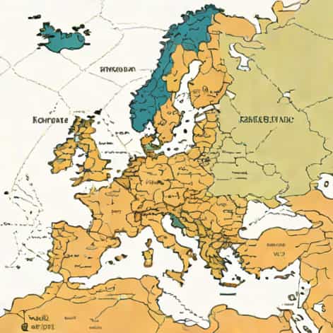
Austerlitz is a name that often evokes historical significance, particularly in the context of European history, and its location on a map can provide both geographical and cultural context. Known primarily for the famous Battle of Austerlitz in 1805, which is also called the Battle of the Three Emperors, Austerlitz is a small town with a prominent historical legacy. Understanding where Austerlitz is located helps in studying European history, military strategies, and the geographical factors that influenced major historical events. This topic explores the location of Austerlitz on a map, its geographical features, and its importance for travelers and history enthusiasts alike.
Geographical Location of Austerlitz
Austerlitz is located in Central Europe, within the boundaries of the modern Czech Republic. Historically, it was part of the Austrian Empire and is known in Czech as Slavkov u Brna. On a map, it lies in the South Moravian Region, a significant administrative area of the Czech Republic. The town is situated approximately 10 kilometers east of Brno, which is the second-largest city in the country. Its strategic location near Brno played a crucial role during historical military campaigns, making it more than just a minor settlement on a map.
Coordinates and Map Details
For those using a detailed map or GPS, Austerlitz is positioned at approximately 49.1500° N latitude and 16.7667° E longitude. This places the town in the eastern part of the South Moravian Region, near the D1 highway, which connects Brno to Prague. The surrounding region features rolling hills, agricultural land, and small forests, which historically influenced troop movements and battle strategies during the Napoleonic era. Being able to locate Austerlitz precisely on a map allows historians, tourists, and students to contextualize its significance within Central Europe.
Historical Significance
The Battle of Austerlitz, fought on December 2, 1805, is one of the most famous battles in European history. Napoleon Bonaparte’s French forces defeated the Russian and Austrian armies, cementing his reputation as a military genius. The location of Austerlitz on a map is therefore not just a matter of geography but also a key reference point for understanding European political and military history. The terrain around Austerlitz, including the Pratzen Heights, played a pivotal role in Napoleon’s battle strategy, demonstrating how geography and history are intertwined.
Why the Map Matters for History
- Identifying troop positions and movements during the battle
- Understanding how terrain influenced military strategies
- Visualizing the proximity of major cities like Brno and Vienna
- Tracing routes for modern-day historical tourism and reenactments
- Connecting historical events to current geographic boundaries
Knowing where Austerlitz is located allows students of history to better grasp the practical challenges faced by armies in the early 19th century and the strategic advantages offered by the landscape.
Modern-Day Austerlitz
Today, Austerlitz is known as Slavkov u Brna, and it serves as a small yet historically rich town in the Czech Republic. On a modern map, the town is easily identifiable thanks to its proximity to Brno and the D1 highway. Despite its modest size, the town attracts visitors interested in Napoleonic history, offering museums, monuments, and guided tours that explain the significance of the Battle of Austerlitz. The modern town balances historical preservation with contemporary living, providing cultural insights as well as geographic orientation.
Tourist Attractions
- Austerlitz Castle – A historical building with exhibits on the battle
- Napoleonic monuments and statues commemorating the 1805 victory
- Walking trails along the historical battlefield areas
- Local museums offering maps and strategic layouts of the battle
- Cultural events that reenact historical moments for educational purposes
Locating Austerlitz on a map is essential for planning visits and understanding the spatial relationships between the battlefield, the town center, and nearby historical landmarks.
Using Maps to Explore Austerlitz
Modern mapping technologies, including online platforms and GPS devices, make it easier than ever to locate Austerlitz and explore its surroundings. Using a map, one can identify the distance from major cities like Brno (about 10 km west) and Vienna (approximately 130 km south). Topographic maps can reveal the elevation changes, hills, and natural features that were critical during the battle, while road maps and satellite images help tourists navigate the modern infrastructure. Maps provide both historical context and practical guidance for contemporary visitors.
Types of Maps to Use
- Political maps showing national and regional boundaries
- Topographic maps highlighting terrain and elevation
- Road maps for modern navigation to the town and nearby cities
- Historical maps illustrating troop movements and battle strategies
- Tourist maps marking museums, monuments, and walking trails
Combining different types of maps allows for a comprehensive understanding of Austerlitz, both as a geographic location and as a site of historical significance.
Why Austerlitz Still Matters Today
Understanding where Austerlitz is on a map is not just about geography; it connects us to history, culture, and education. The town represents the enduring legacy of one of Europe’s most famous military victories and serves as a reminder of the influence of geography on historical events. Scholars, tourists, and educators can all benefit from studying Austerlitz’s location and using maps to explore its impact on European history.
Educational Benefits
- Learning about the relationship between geography and military strategy
- Analyzing historical maps to understand troop movements
- Exploring how historical borders and settlements have changed over time
- Connecting historical events to modern-day locations and infrastructure
The map of Austerlitz provides a visual tool to better comprehend historical events and their spatial context, making history more tangible and accessible.
Austerlitz, located in the South Moravian Region of the Czech Republic near Brno, is a small town with a significant historical legacy. Known for the Battle of Austerlitz in 1805, the town’s location on a map provides insights into European history, military strategy, and cultural heritage. From the Pratzen Heights to the modern town of Slavkov u Brna, understanding the geography of Austerlitz enhances appreciation for both its historical and contemporary significance. Whether for education, travel, or historical study, locating Austerlitz on a map helps people connect with an important chapter of European history while exploring the town’s enduring cultural and geographical features.