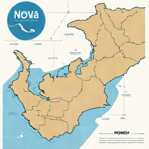
Exploring the Nova Scotia Bay of Fundy region often begins with understanding its unique geography, and a detailed Bay of Fundy map becomes an essential guide. This area is famous for having the highest tides in the world, dramatic coastlines, and rich marine ecosystems. Travelers, researchers, and nature enthusiasts rely on clear geographic descriptions to plan trips, identify key attractions, and appreciate how the shoreline changes from one community to another. A well-explained layout of the Bay of Fundy helps visitors navigate safely while discovering the natural beauty that defines this remarkable location.
Overview of the Bay of Fundy region
The Bay of Fundy lies between the Canadian provinces of Nova Scotia and New Brunswick, extending into the Gulf of Maine. Its shape and depth create an extraordinary tidal range that can exceed 15 meters in some areas. When looking at a Nova Scotia Bay of Fundy map, you’ll notice that the bay narrows as it approaches the Minas Basin. This funnel-like design amplifies the tides, leading to dramatic rises and falls that attract visitors from around the world.
Geographic boundaries and features
The bay stretches approximately 270 kilometers, connecting several important subregions. A map reveals how the bay branches into smaller basins and harbors, each offering different landscapes and water conditions. These divisions are important for understanding tidal behavior, navigation routes, and sightseeing locations. The combination of cliffs, mudflats, rock formations, and coastal towns makes the Bay of Fundy one of the most geographically diverse areas in Canada.
- Minas Basin on the Nova Scotia side
- Cobequid Bay as an extension of the basin
- Chignecto Bay bordering both provinces
- Grand Manan Island at the mouth of the bay
Understanding the Nova Scotia side of the Bay of Fundy
The Nova Scotia shoreline along the Bay of Fundy is known for scenic coastal highways, fishing communities, and geological features shaped by centuries of tidal movement. A Nova Scotia Bay of Fundy map clearly marks key towns such as Truro, Wolfville, Parrsboro, and Digby. Each town has access to different viewpoints, tidal experiences, and nature trails that highlight the area’s unique ecology.
Minas Basin and its importance
Minas Basin is one of the most recognizable parts of the map. Forming a broad extension from the bay, the basin’s narrow opening increases tidal force dramatically. This area is famous for tidal bores, fossil cliffs, and protected shorelines rich in birdlife. Locations such as Burntcoat Head, home to the world’s highest tides, are typically marked on tourist and environmental maps because of their global scientific value.
Communities along the Nova Scotia coast
Coastal communities help visitors interpret the map more easily. Each region along the bay has distinct characteristics shaped by maritime culture, fishing traditions, and geological formations.
- WolfvilleLocated near the agricultural Annapolis Valley, it offers views of tidal flats and the Minas Basin.
- ParrsboroKnown for dramatic cliffs and fossil discoveries.
- DigbyFamous for scallop fishing and whale-watching tours.
- TruroA key location to observe the tidal bore along the Shubenacadie River.
Interpreting a Bay of Fundy map
Even without visual aids, understanding how to read a map of the Bay of Fundy begins with recognizing its contours and natural divisions. The bay forms a wide mouth that gradually narrows until it reaches the Minas Channel. From there, smaller inlets, coves, and basins spread across the Nova Scotia side. Land elevations, represented on a map by shaded relief, help illustrate where cliffs, headlands, and lower-lying mudflats are located.
Key elements to look for on a map
A clear and informative map highlights water depth, coastal access points, and natural features. This is especially useful for travelers interested in hiking or tide watching, since the terrain varies significantly.
- Marked tide interpretation centers
- Provincial parks and protected areas
- Deep-water channels
- Ferry routes, particularly near Digby
Elevation and tide indicators
Some maps include tide charts or elevation indicators to help visitors time their activities. For example, knowing when the tide retreats can help plan coastal walks at Burntcoat Head or Five Islands Provincial Park. Maps that overlay tidal information with trail networks also help visitors avoid unsafe areas, especially where tides rise and fall quickly.
Natural attractions shown on the map
A Nova Scotia Bay of Fundy map typically highlights various sites that attract tourists, scientists, and photographers. These places showcase the beauty of the region while also offering insight into geological history and marine life. Because the tides expose different layers of Earth’s past, many areas along the bay are designated for research and conservation.
Iconic coastal features
Various geological formations along the bay are directly shaped by tidal erosion. These structures are important for understanding the bay’s physical environment and are therefore commonly labeled on maps.
- Sandstone cliffs at Five Islands
- Worn sea stacks along the coast
- Mudflats that stretch for kilometers during low tide
- Salt marshes around the Minas Basin
Marine life hotspots are also included. Bay of Fundy maps usually mark whale-watching locations near Digby Neck, Long Island, and Brier Island. These areas are home to humpback whales, minke whales, and other marine mammals that thrive in the nutrient-rich waters of the bay.
How the Bay of Fundy map helps travelers
Whether planning a short visit or a coastal road trip, understanding the map helps travelers navigate safely and efficiently. The shoreline is vast and diverse, so knowing where to find observation platforms, access trails, and parking areas makes a meaningful difference. Most coastal attractions depend on tide timing, so pairing a map with tide schedules can help avoid missed opportunities.
Planning sightseeing routes
Many visitors choose to follow scenic byways along the Nova Scotia coast. A map helps identify which routes offer the best views of the bay, where rest stops are located, and how the landscape changes from one community to another. By comparing distances between towns, travelers can schedule stops for food, hiking, or photography.
Understanding safety zones
Because tides can rise rapidly, maps also help identify safe and unsafe areas. Some coastal trails can be entered only during low tide and require careful timing. Knowledge of the dip and rise of the shoreline helps prevent accidents and ensures a smooth travel experience.
Environmental and scientific value of the mapped region
The Bay of Fundy is not only a tourist destination but also a natural laboratory for scientists studying climate change, erosion, sediment movement, and marine ecosystems. Maps play a crucial role in documenting changes to the coastline and identifying regions vulnerable to sea-level rise. By understanding these geographic features, researchers can better predict how the environment will evolve.
Mapping geological history
Cliffs across the Bay of Fundy contain fossils dating back millions of years. Maps help locate these fossil sites, making it easier for scientists and educators to conduct field research. These areas show how long-term erosion and tidal activity continually reshape the coast.
Ecosystem mapping
Tidal flats, salt marshes, and rocky shores all support different species. Ecologists use detailed maps to track habitat changes, migration patterns, and biodiversity levels. Because the bay’s environment is so dynamic, continuous mapping is essential for long-term conservation.
A Nova Scotia Bay of Fundy map serves as more than a simple navigation tool. It provides insight into geography, ecology, culture, and natural history. Understanding the bay’s structure from the Minas Basin to coastal communities like Digby and Parrsboro helps travelers appreciate the region’s extraordinary landscape. Whether used for tourism, research, or education, a clear grasp of the Bay of Fundy’s geography enriches the experience of exploring one of Canada’s most remarkable natural wonders.