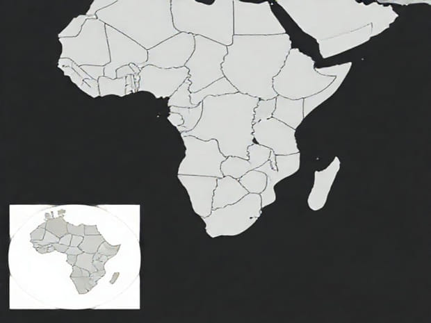
Sub-Saharan Africa is a vast and diverse region that stretches across the continent south of the Sahara Desert. This area encompasses over 40 countries, each with its own unique geography, culture, language, and history. Understanding the layout of these countries on a map is essential for students, researchers, and travelers who wish to grasp the geographic and political complexity of the region. A detailed map of Sub-Saharan Africa not only illustrates the borders and locations of individual countries but also highlights the relationships between them, regional groupings, and key geographic features that shape human and economic activities across the region.
Overview of Sub-Saharan Africa
Sub-Saharan Africa excludes the countries of North Africa, which are generally considered part of the Arab world and the Mediterranean region. The region includes a wide variety of landscapes, from dense rainforests and savannas to mountains, plateaus, and coastal plains. Countries in Sub-Saharan Africa are home to more than one billion people, representing thousands of ethnic groups and languages. This region is often divided into subregions for ease of study, including West Africa, East Africa, Central Africa, and Southern Africa.
Subregions and Key Countries
- West AfricaIncludes countries such as Nigeria, Ghana, Senegal, Ivory Coast, and Mali. This subregion is known for its rich cultural heritage, bustling cities, and significant economic activity.
- East AfricaEncompasses Kenya, Tanzania, Uganda, Rwanda, and Ethiopia. East Africa is characterized by the Great Rift Valley, vast savannas, and important wildlife reserves.
- Central AfricaComprising countries like the Democratic Republic of Congo, Cameroon, Gabon, and the Central African Republic. This region is known for dense rainforests and significant mineral resources.
- Southern AfricaIncludes South Africa, Botswana, Namibia, Zimbabwe, and Zambia. Southern Africa features deserts, mountains, and diverse ecosystems, along with some of the continent’s most developed economies.
Importance of Maps in Understanding Sub-Saharan Africa
Maps are critical tools for visualizing the location and relationships of countries within Sub-Saharan Africa. They allow individuals to comprehend distances, neighboring countries, natural boundaries such as rivers and mountains, and strategic locations. For example, maps can show how Nigeria borders multiple West African countries, or how Kenya lies along the eastern coastline of Africa. This geographic understanding aids in the study of trade, migration, environmental challenges, and regional cooperation.
Political and Physical Maps
Political maps focus on the borders and administrative divisions of countries, making it easier to identify each nation within Sub-Saharan Africa. Physical maps, on the other hand, emphasize geographic features such as the Congo River, Mount Kilimanjaro, the Kalahari Desert, and the Great Rift Valley. Both types of maps are valuable for understanding the interplay between natural landscapes and human activity in the region.
Geographic Features of Sub-Saharan Africa
The geography of Sub-Saharan Africa is incredibly varied and plays a significant role in shaping settlement patterns, agriculture, and transportation. Key geographic features include
- RiversMajor rivers like the Niger, Congo, Zambezi, and Limpopo provide water for agriculture, transport routes, and hydroelectric power.
- Mountains and HighlandsFeatures such as Mount Kilimanjaro, the Ethiopian Highlands, and the Drakensberg Mountains affect climate and biodiversity.
- Deserts and Arid RegionsThe Kalahari and Namib deserts influence human settlement and trade patterns in southern Africa.
- Coastal RegionsThe Atlantic and Indian Oceans provide access for international trade and support fishing communities.
- Forests and SavannasDense rainforests in Central Africa and savannas in East and West Africa support diverse wildlife and agriculture.
Economic and Cultural Insights from Maps
Maps of Sub-Saharan Africa not only show political boundaries but also provide insights into the region’s economic and cultural landscape. For example, Nigeria, located in West Africa, is the most populous country in the region and a significant oil producer. South Africa in the south has diverse mineral resources and advanced infrastructure. East African countries like Kenya and Tanzania rely on agriculture and tourism. Understanding these patterns on a map helps illustrate the connections between geography, resources, and economic development.
Population and Urban Centers
- Lagos, NigeriaOne of the largest cities in Africa and a major economic hub in West Africa.
- Nairobi, KenyaA key urban center in East Africa known for trade and finance.
- Kinshasa, Democratic Republic of CongoThe capital city located along the Congo River, central to Central Africa.
- Johannesburg, South AfricaA major economic and industrial center in Southern Africa.
Using Maps for Education and Research
Educational institutions often use maps of Sub-Saharan Africa to teach geography, history, and economics. Researchers use these maps to study climate change impacts, migration trends, and political boundaries. For travelers, maps provide essential information for planning trips and understanding regional differences in culture and infrastructure. Interactive digital maps have also enhanced accessibility, allowing users to zoom in on individual countries and explore detailed geographic information.
Benefits of Understanding Sub-Saharan Africa through Maps
- Identifying countries and understanding their relative locations.
- Visualizing natural resources and environmental features.
- Understanding regional cooperation and trade routes.
- Planning for travel, research, and development projects.
- Gaining insights into cultural and linguistic diversity across countries.
Sub-Saharan Africa is a dynamic and diverse region with over 40 countries, each contributing to the cultural, economic, and geographic richness of the area. Maps are invaluable tools for understanding the layout, borders, and natural features of the region. From the deserts of Southern Africa to the rainforests of Central Africa, and from the bustling cities of West Africa to the scenic landscapes of East Africa, maps help illustrate the complexity and beauty of Sub-Saharan Africa. Whether for education, research, or travel planning, a detailed map of the region provides essential insights into its geography, economy, and culture, fostering a deeper appreciation of this vibrant part of the world.