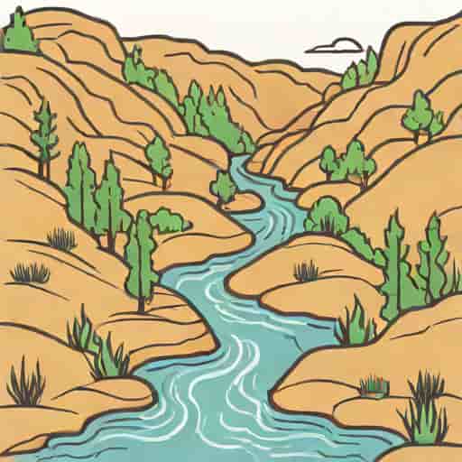
The Guadalupe River headwaters in Texas mark the beginning of one of the most significant and beloved river systems in the state, rising from the springs and streams of southwestern Kerr County before flowing over 230 miles toward the Gulf of Mexico. This river’s origin feeds ecosystems, supports recreation, and shapes landscapes throughout central and southeast Texas. For outdoor enthusiasts, nature lovers, and residents alike, the headwaters area of the Guadalupe River represents both a scenic natural environment and an essential part of the region’s water system. Understanding where the Guadalupe River begins, how its forks form, and why this headwater region matters adds depth to any conversation about Texas rivers and natural heritage.
Where the Guadalupe River Begins
The Guadalupe River’s headwaters form in the Texas Hill Country, specifically in southwestern Kerr County. Here, two primary forks – the North Fork and the South Fork – originate from springs, groundwater discharge, and small tributaries that drain the limestone hills of the Edwards Plateau region. These smaller streams converge near the community of Hunt, Texas, to create the main stem of the Guadalupe River. The elevation at the headwaters is roughly 1,735 to 2,360 feet above sea level, depending on the specific spring source and terrain in this part of the state.
North Fork and South Fork Origins
The North Fork rises just south of State Highway 41, only a few miles from the Real County line, with water fed by groundwater and hillside springs. The South Fork begins southwest of the intersection of State Highway 39 and Farm Road 187, with its own network of minor springs and runoff channels. After flowing northeast and east respectively, the two forks unite to form the Guadalupe River proper. This confluence near Hunt is widely regarded as the official headwater location.
Geography and Natural Environment
The headwaters of the Guadalupe River sit within the Edwards Plateau ecoregion, an area known for its rugged limestone landscapes, groundwater springs, and unique biodiversity. As the river begins here, the water is clear, shallow, and often flows over rocky beds lined with cypress and other native vegetation. These upper reaches are less developed and offer a more natural river environment compared to lower sections downstream closer to towns and cities.
Climate and Aquifer Influence
The base flow at the Guadalupe River headwaters is heavily influenced by groundwater discharge, mainly from the Edwards-Trinity aquifer system. During dry seasons, surface runoff may diminish, but the aquifer’s steady discharge still supplies water to the upper river. This connection between aquifer and river marks the importance of groundwater in supporting the Guadalupe’s flow yearround.
Ecological Importance of the Headwater Region
Headwater regions like those of the Guadalupe River are critical for maintaining healthy river systems. They act as nurseries for aquatic life, provide clean water inputs downstream, and support riparian habitats that host diverse plant and animal species. The upper Guadalupe’s banks, shaded by trees and nourished by clear water, create habitats where species from fish to birds thrive. Preserving this headwater environment contributes to the overall ecological integrity of the entire river basin.
Flora and Fauna Near the Source
Near the headwaters, plant communities include bald cypress along the water course, oak woodlands on surrounding hills, and grasses that thrive in limestone soils. Wildlife is abundant, with aquatic species in the river and terrestrial species in nearby woodlands. This biodiversity supports the environmental value of the area and enhances its appeal for naturebased recreation.
Recreation Along the Upper Guadalupe River
Although the headwaters themselves can be less accessible for casual recreation, the upper Guadalupe River and its surroundings offer numerous opportunities for outdoor activities. Hiking, bird watching, fishing, and nature photography draw visitors to this scenic part of Texas. As the river continues downstream, it becomes increasingly popular for tubing, kayaking, and swimming – especially around areas near Canyon Lake and beyond.
Popular Activities Downstream
- Hiking near river springs and limestone outcrops
- Bird watching along shaded riverbanks
- Fishing in deeper pools where fish species thrive
- Water sports such as tubing and kayaking in downstream sections
The Upper Guadalupe’s flowing water also makes it suitable for paddle sports when flows are favorable, while below Canyon Lake Dam, recreation becomes even more concentrated.
Water Quality and Conservation Considerations
Water quality in the Guadalupe River headwaters is generally high thanks to springfed flows and natural filtration through limestone. However, conservation efforts remain essential to protect this quality from pollution, overuse of groundwater, and impacts from development. Maintaining the health of the headwaters supports water quality downstream, benefiting communities, agriculture, wildlife, and recreation throughout the basin.
Threats and Challenges
Despite its ecological importance, the Guadalupe River basin faces challenges such as nutrient runoff, low dissolved oxygen levels in some downstream sections, and algal growth that can affect aquatic life. Monitoring stations throughout the watershed help track these factors, enabling targeted efforts to protect water quality.
Cultural and Historical Significance
The Guadalupe River has been an important natural and cultural resource for centuries. Its name, derived from Spanish explorers who named many places in Texas, reflects early European influence in the region. Over time, the river sustained Indigenous communities, settlers, and modern residents alike, shaping settlement patterns and economic activities. The headwaters region, while less populated, has contributed to this legacy as the origin of a major waterway in Texas.
Role in Local Heritage
For local residents and Indigenous groups, the Guadalupe River has provided water, food, and transportation routes. It also holds recreational and aesthetic value, forming part of Texas’s natural heritage and identity. As a result, many communities along the river celebrate its presence through festivals, outdoor traditions, and stewardship initiatives that recognize its historical and environmental importance.
How the Headwaters Shape the Larger River
The headwaters set the stage for the river’s journey, influencing flow patterns, water quality, and ecological dynamics far downstream. By studying the upper river and its source streams, scientists and conservationists gain insights into how best to manage and protect this vital water resource. Healthy headwaters help ensure the Guadalupe River remains a lifeline for central and southeast Texas as it travels toward San Antonio Bay and eventually the Gulf of Mexico.
Tributaries and Flow Contributions
After the headwaters combine to form the main stem, other significant tributaries such as the Blanco, Comal, and San Marcos rivers join the Guadalupe, expanding its flow and ecological reach. These tributaries, fed by springs and surface runoff, contribute to the river’s overall volume and health, reinforcing the importance of protecting headwaters throughout the watershed.
The Guadalupe River headwaters in southwestern Kerr County are more than just the start of a river; they are the foundation of a complex and dynamic waterway that supports diverse ecosystems, recreational opportunities, and cultural connections throughout Texas. From the convergence of its North and South forks to the springfed flows that sustain its upper reaches, the headwater region embodies both natural beauty and ecological significance. Protecting this source and understanding its role within the larger watershed helps ensure that the Guadalupe River continues to enrich the landscapes and communities it touches for generations to come.