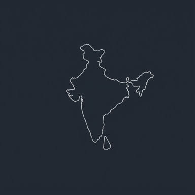
India, with its vast and diverse geography, stretches from the snow-covered Himalayas in the north to the tropical shores in the south, and from the arid deserts in the west to lush green hills in the east. Understanding which state lies furthest east can help enhance geographic awareness and provide deeper insights into India’s borders and regional characteristics. The easternmost state of India holds significance due to its strategic location, cultural uniqueness, and proximity to international borders. This topic explores the easternmost point in India and identifies which state claims this geographically important position.
Locating the Easternmost State of India
Understanding Geographical Extremes
Geographical extremes like the northernmost, southernmost, easternmost, and westernmost points are often used to define the boundaries of a country. In India, these points are not just geographical trivia but are deeply tied to national identity, defense strategy, and regional development.
When we talk about the easternmost state of India, we are referring to the state that contains the point located farthest to the east within the official boundaries of the country. This position must be measured longitudinally, using degrees east of the Prime Meridian.
The State That Lies Farthest East
The easternmost state of India is Arunachal Pradesh. Situated in the northeastern part of the country, Arunachal Pradesh shares international borders with three countries Bhutan to the west, China to the north and northeast, and Myanmar to the east. Among all the states in India, it extends the farthest to the east in terms of longitudinal coordinates.
The Easternmost Point Kibithu in Arunachal Pradesh
Geographic Coordinates
The specific location often cited as the easternmost point of India is the small town of Kibithu in Anjaw district, Arunachal Pradesh. Kibithu is positioned at approximately 97.4°E longitude. It is nestled in the eastern Himalayas, close to the McMahon Line, the de facto border between India and China.
Here are some notable facts about Kibithu
- It lies near the India-China-Myanmar tri-junction.
- The Lohit River flows nearby, contributing to the scenic beauty of the area.
- The town holds military significance due to its proximity to the border.
Time and Sunrise
Due to its far eastern position, Kibithu and surrounding areas experience sunrise much earlier than the rest of India. In fact, Arunachal Pradesh sees the first sunrise in the country, often up to two hours before cities like New Delhi or Mumbai. This has led to ongoing discussions about establishing a separate time zone for northeastern India to align better with daylight hours.
Arunachal Pradesh An Overview
Location and Borders
Arunachal Pradesh is located between latitudes 26.28°N to 29.30°N and longitudes 91.20°E to 97.30°E. It is the largest state in the northeastern region in terms of area, covering approximately 83,743 square kilometers. The state borders
- Assam and Nagaland to the south
- Bhutan to the west
- China (Tibet Autonomous Region) to the north and northeast
- Myanmar to the southeast
Ethnic and Cultural Diversity
Arunachal Pradesh is home to a variety of indigenous tribes and ethnic groups, each with its own language, customs, and traditions. Prominent tribes include the Nyishi, Apatani, Adi, Galo, and Mishmi. The rich cultural tapestry of the region adds depth to its geographic significance.
Terrain and Climate
The terrain is largely mountainous and forested, with deep valleys and swiftly flowing rivers. The Eastern Himalayas dominate the landscape, providing a cool and wet climate. Monsoon rains are heavy, and snowfall is common in the higher elevations during winter months.
Why the Easternmost Region Matters
Strategic and Military Importance
Due to its location near sensitive international borders, Arunachal Pradesh has major strategic importance. India maintains a strong military presence in the region to safeguard national interests. The border dispute with China, especially over the Tawang region, has kept the area in geopolitical focus.
Development Challenges
Despite its natural beauty and cultural richness, the state faces challenges related to infrastructure, connectivity, and access to basic services. The terrain makes road building difficult, and many remote villages remain isolated. The government has launched multiple development initiatives to integrate the region more closely with the rest of India.
Tourism Potential
With its stunning landscapes, biodiversity, and tribal heritage, Arunachal Pradesh is a potential paradise for eco-tourism and cultural tourism. Destinations like Tawang, Ziro Valley, and Namdapha National Park attract visitors who seek off-the-beaten-path adventures and serene environments.
Other Northeastern States Close in Longitude
States Nearby in the East
While Arunachal Pradesh holds the title of the easternmost state, several other northeastern states also lie in the far eastern part of India. These include
- AssamShares a long border with Arunachal Pradesh and stretches eastward near the Brahmaputra Valley.
- NagalandLocated south of Arunachal Pradesh, with some eastern districts nearing Myanmar.
- Manipur and MizoramAlso extend toward the east but do not reach as far as Kibithu.
However, none of these states extend as far east as Arunachal Pradesh, particularly its easternmost district, Anjaw.
Mapping the Extremes From West to East
Other Geographical Extremes of India
To place Arunachal Pradesh in perspective, it helps to understand India’s other extremities
- Westernmost PointGuhar Moti in Gujarat near the border with Pakistan
- Northernmost PointIndira Col in the Siachen Glacier region of Ladakh
- Southernmost PointIndira Point in the Nicobar Islands (Andaman and Nicobar Union Territory)
- Easternmost PointKibithu, Arunachal Pradesh
Time Zones and Geography
The difference in longitude between the eastern and western extremities of India is significant. India officially follows Indian Standard Time (IST), which is UTC+530. However, this unified time zone often causes the northeastern states to experience daylight much earlier than the rest of the country. The demand for a second time zone often referred to as Eastern Standard Time” has been proposed by experts and local leaders.
In summary, Arunachal Pradesh is the easternmost state of India, with Kibithu in the Anjaw district marking the furthest eastern point within the nation’s borders. This location holds geographical, cultural, and strategic importance. Its remote position highlights the challenges of connectivity and development while offering rich biodiversity and cultural uniqueness. Understanding the geographical extremes of India helps foster a deeper appreciation for the country’s vast landscape and diverse regions. Whether viewed from a map or explored in person, the easternmost state of India stands as a key area in both national identity and global positioning.